Plug and Play with your own Data
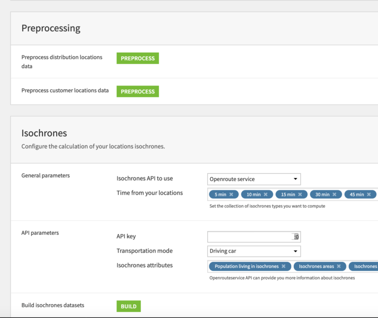
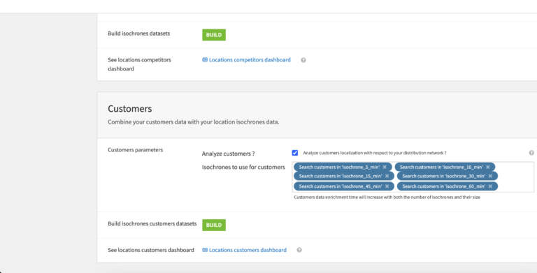
The primary entry point to this solution is the pre-built Dataiku Application which allows us to easily upload our data and adjust the project to our needs.
Explore !This project offers a plug and play solution allowing retail analytics teams to understand the spatial footprint of their distribution network using a Dataiku powered WebApp. With easy tailoring of the project through a Dataiku Application and capacity to adjust the data flow to their needs, the Distribution Spatial Footprint enables retail companies to reinforce their distribution strategies. More details on the specifics of the solution can be found on the knowledge base. This solution is available on installed instances and Dataiku Online.
Geospatial analysis is a set of techniques aiming at collecting, processing and analyzing data from all kinds of technologies such as GPS, location sensors, satellites etc. It uses any data that has a geographic component attached to it, including geographic coordinates and specific identifiers such as street address and zip code.
For retailers and all other activities highly dependent on end-customer facing through stores and other distribution points, understanding how to best structure this network is critical, with the potential of generating up to a 20% in sales increase. Achieving these results demands optimizing both global and local network strategies through a broad scope of use-cases:

The primary entry point to this solution is the pre-built Dataiku Application which allows us to easily upload our data and adjust the project to our needs.
Explore !
By looking at the flow, we can get a sense of the flow zones that represent the high level steps we can impact with parameters in the Dataiku Application in order to turn our input data into ready-to-visualize outputs.
Explore !
Compute isochrones for each of the POS in our network using open source APIs in order to see the reach of our distribution network.
Explore !
Further enhance our geospatial analysis by uploading customer data to identify customers located within, and outside of, our distribution network.
Explore !
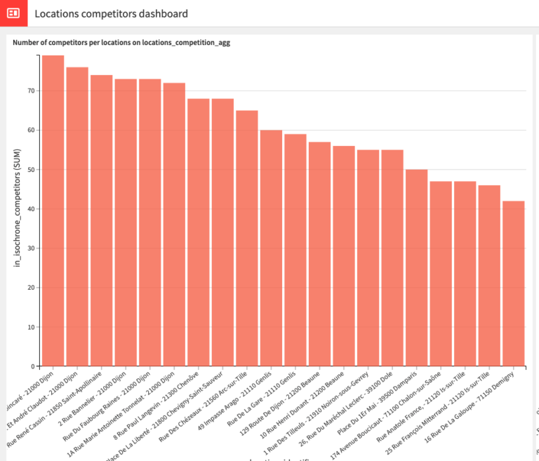
Get a quick and shareable view of our distribution network, customer spread, and overlap of our network with competitors with prebuilt graphs specifically designed to quickly understand the output of the flow.
Explore !
Explore our Distribution Spatial Footprint in a visually rich and interactive WebApp which can easily be used by analytics teams to answer a variety of business questions.
Explore !